
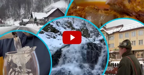
The Ukrainian blogger visited the highest mountain city in Ukraine and tasted cabbage rolls near the Romanian border.
Transcarpathia is a picturesque, diverse and sometimes even mysterious region
The westernmost region of Ukraine is Zakarpattia. The region borders on four countries: Poland, Slovakia, Hungary and Romania.
Occupying an important geographical position on the southern slopes of the Ukrainian Carpathians, Transcarpathia, which at different times was called "Hungarian Rus", "Carpathian Rus", "Russian Kraina", "Subcarpathian Rus", "Carpathian Ukraine", "Transcarpathian Ukraine", and since January 22, 1946 - Transcarpathian region as part of the Ukrainian SSR, has long been a kind of bridge between East and West.
The highest mountain region of Transcarpathia
In the video, the blogger showed the mountainous Rakhiv region.
"In this issue, I will travel almost a thousand kilometers to show you the secret places of Transcarpathia. Our trip will be full of impressions and emotions, because we will discover the Rakhiv region in a new way. We will find fantastic Carpathian landscapes, walk wild paths in search of the Love waterfall, find a vat of mineral water, go for cabbage rolls all the way to the Romanian border, find out where the highest trident in Ukraine is located, get acquainted with a craftswoman who makes unique paintings from wool, we will taste the top wines of Transcarpathia, walk through the highest mountain city of Ukraine - Rakhiv, make a wish in the village of Dilove - the geographical center of Europe and learn a lot about the unique region - Rakhiv region," the blogger said in the description.
Rakhiv district with the administrative center of the city of Rakhiv, which is the highest mountain city in Ukraine.
Rakhiv district includes four territorial districts, which include 26 settlements.
The district is located in the highest mountainous part of the Ukrainian Carpathians. In the north rise the Pryvododilni (Inner) Gorgans, in the west — Svydovets, in the northeast — Chornohora (mountainous parts of the Polonyna range), in the south — the Rakhiv Mountains.
40 km from Rakhiv, in the Chornohora massif, there is the highest peak of the Ukrainian Carpathians and Ukraine as a whole — Mount Hoverla (2061 m above sea level). Five more two-thousander peaks rise nearby - Brebeneskul, Petros, Pip Ivan Chernogorsky (Black Mountain), ReBra and Gutin Tomnatyk.
One of the largest tributaries of the Danube, the Tisza River, originates in the Rakhiv region. Flowing through the expanses of Europe, it provides clean drinking water to the population of Ukraine, Romania, Hungary, and Slovakia.
For details of the trip to the charming Rakhiv region, see the video:
See also: "Some new species, they bite people": what kind of misfortune fools the inhabitants of the region and makes its way into their homes? (PHOTO FACT)
Do you want to keep abreast of the latest events from the region and beyond? Subscribe to the Telegram channel "Voice of the Carpathians" and be the first to receive the latest information every day!
Читайте також:
- Нашестя змій на Закарпатті: небезпека чатує в будинках та на городах
- Найстрашніше попереду: чим слід уже робити запаси жителям Закарпаття на найближчий період?
- На Закарпатті вимикатимуть світло не тільки по графіку: де ще плануються додаткові відключення (ПЕРЕЛІК)
- Блокпости - не єдине обмеження: закарпатцям "врізали" ще одну заборону в період військового стану
- Поділитись:
- Twitter(X)
- Telegram
- Viber